Cartography is the practice of representing a 3D world onto a 2D surface. Map projections, or the process of transforming the world onto a planar map, whether that be on a piece of paper or on a computer screen, always incurs distortion and thus error. Distortion can occur in properties of area, angles, distance, direction and shape. As a result, another way of selecting an appropriate projection method would be to ask yourself, "what are the appropriate distortions for the purpose of my map?".
Different Types of Projections
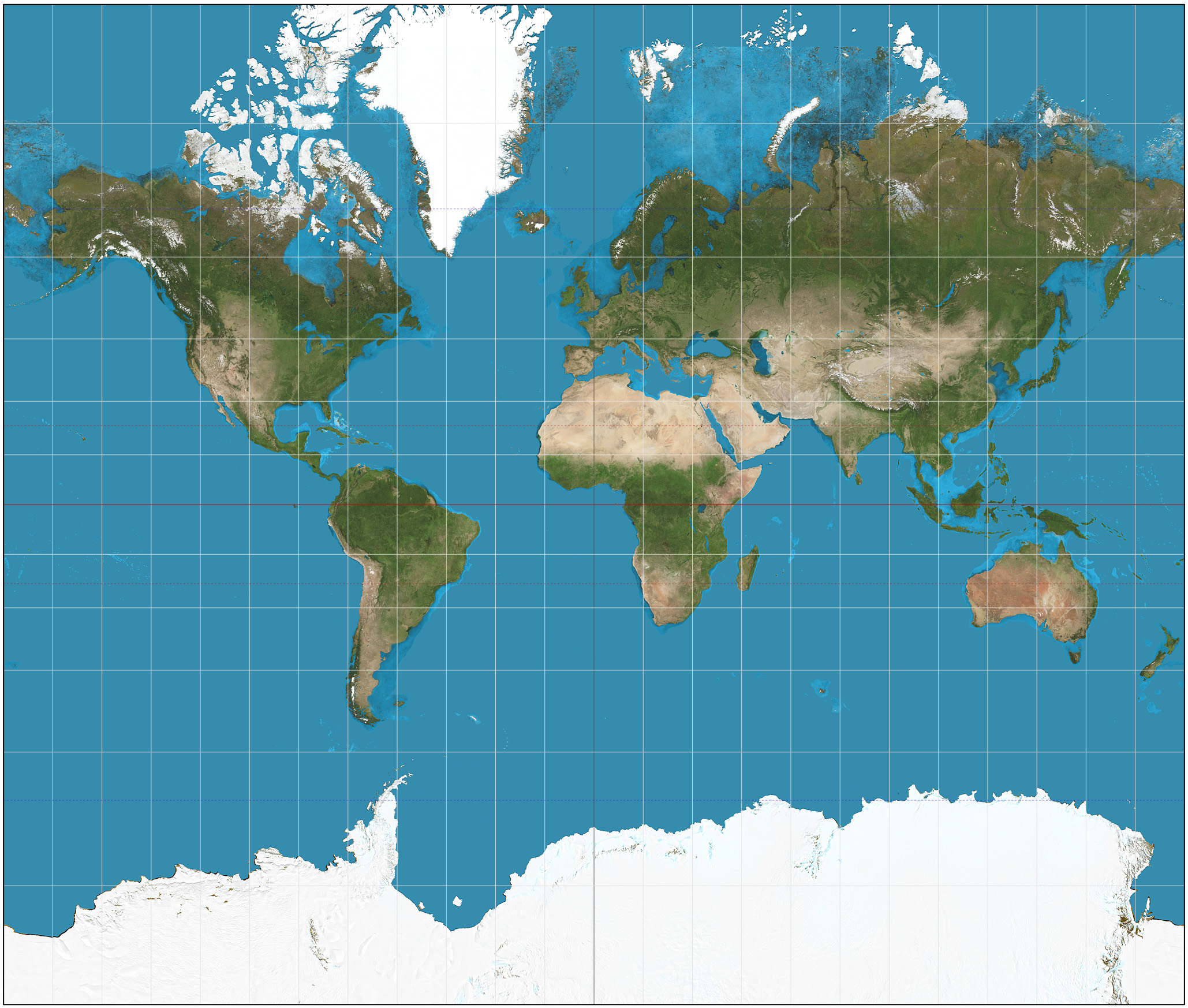
Robinson Projection: Compromise
The Robinson projection is a common example of a compromise projection which sacrifices the preservation of metric properties to strike a balance between properties of distortion, minimizing overall distortion.
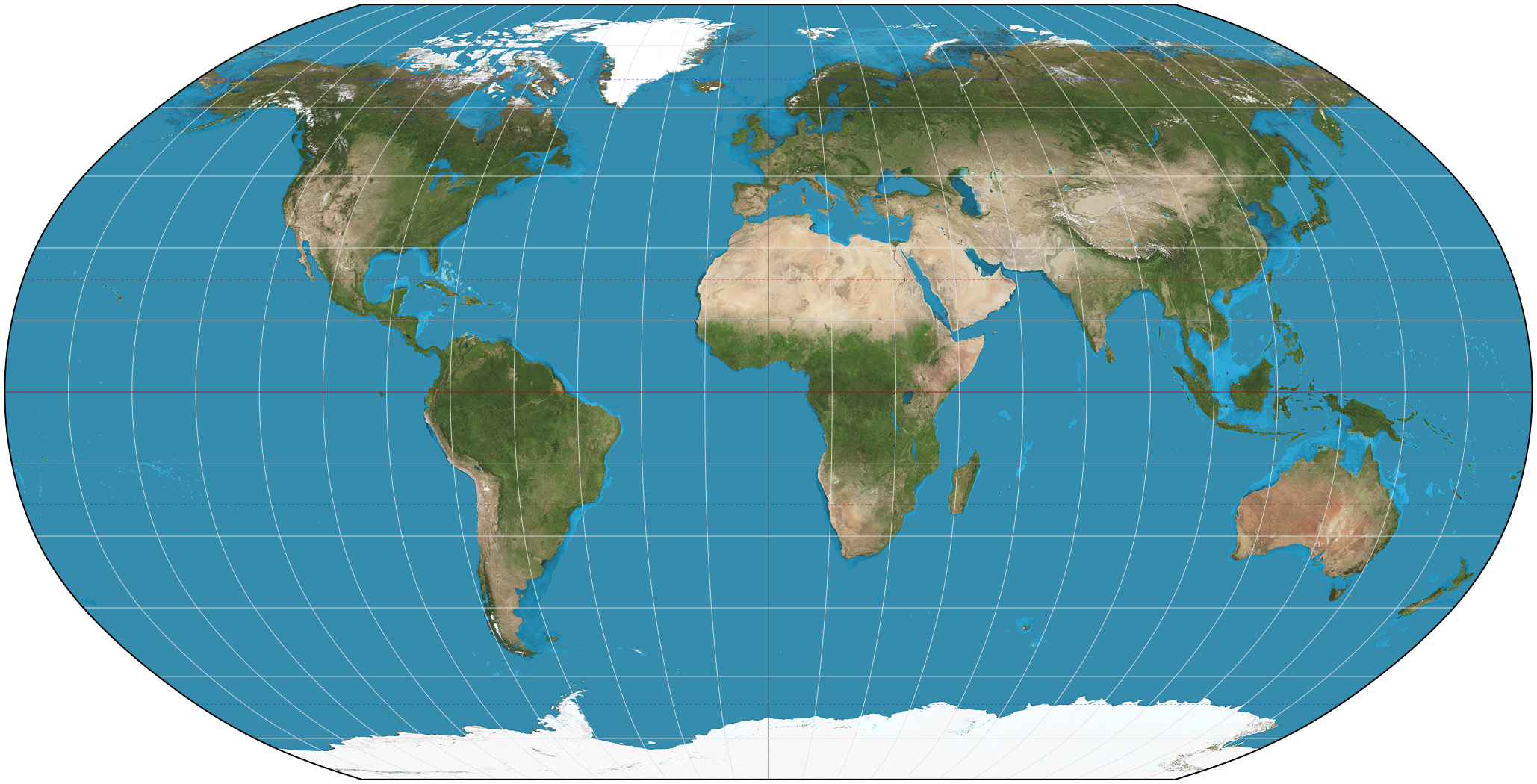
Mercator Projection: Conformal
The Mercator projection, on the other hand, is an example of a conformal projection which preserve angles, shape and directions locally. As a result, the mercator projection is great for navigation and topographic mapping, while having noticeable areal distortions. For example, on a Mercator projection, Greenland is portrayed to be larger than Africa when in fact, Africa is 14x larger than Greenland!
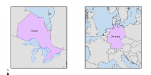
Albers Equal Area Conic Projection: Equal Area/Equivalent
Albers Equal Area Projections are equal area or equivalent projections, where angles and shape are distorted while preserving area. Thus, equal area projections are commonly used for thematic or quantitative mapping, especially when comparing or measuring areal data, such as when one is comparing national park sizes or the percentage of forested land within regions.
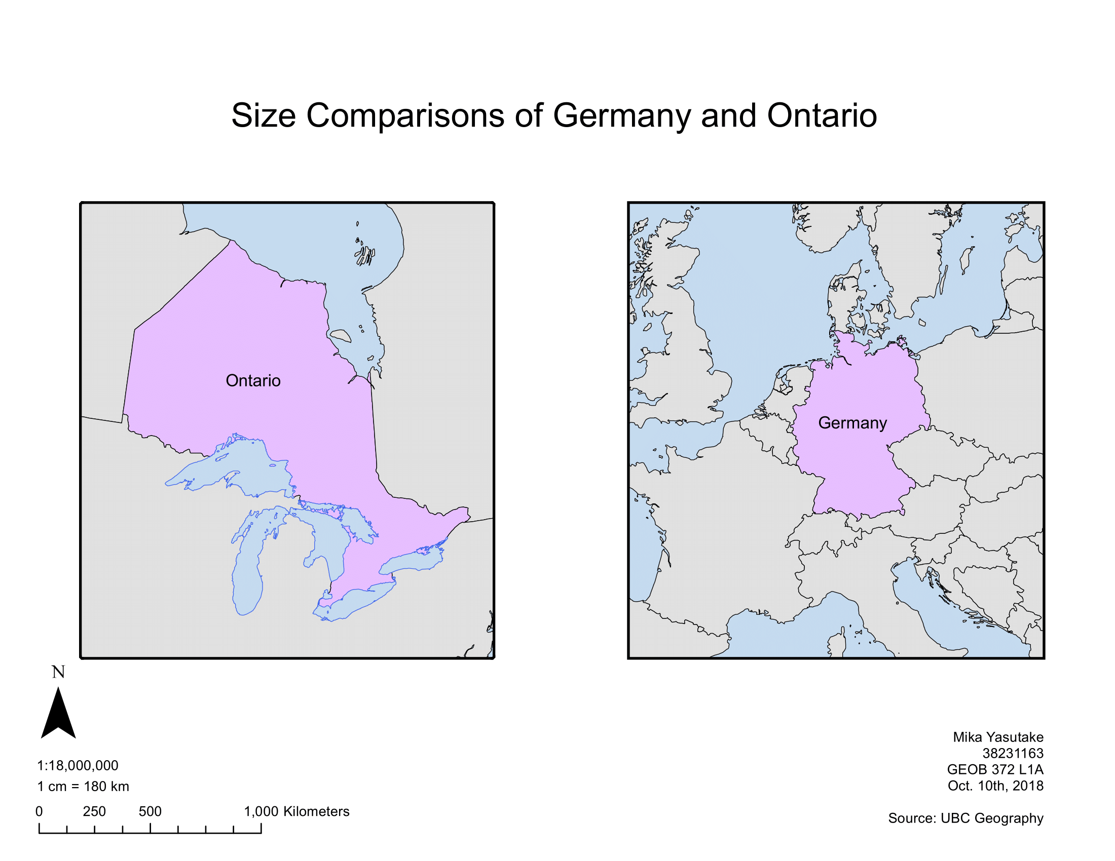
In the above map, the Albers Equal Area Conic projection was used to facilitate size comparisons between Canada's province of Ontario and the Germany. More specifically, I used the Europe Albers Equal Area Conic projection for Germany as the standard parallels and meridians cross through the European continent, mitigating distortion. On the other hand, I created an Ontario Albers Equal Area Conic projection by adjusting the two standard parallels of the North American Albers Equal Area Conic projection to 46 and 51 degrees and central meridian to -86 degrees, to more accurately encompass Ontario.
HERE ARE SOME SKILLS AND LESSONS I'VE GAINED ALONG THE WAY:
- Created a comparative map of size and projected coordinate systems of Germany and Ontario on ArcGIS
- Adjusted standard parallels and central meridians of a projected coordinate system in ArcGIS to create maps better suited for its purposes
- Compared different projection types to understand the importance and implications of choosing appropriate projections in cartography