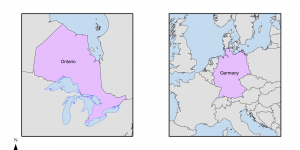
Comparing Areal Sizes with Map Projections
Map projections, or the presentation of something onto a flat surface, is an important element of cartography, and entails distortions and implications for how our 3D world can be understood. In this assignment, projection types have been edited on ArcGIS to make a comparative map of the sizes of Germany and Ontario.