Cartography - What is it?
Cartography can be understood as the art, science, and technology surrounding map-making and depicting spatial relationships. Cartography is largely interested in effective and efficient visual communication of space and positioning, where the magic lies in the fact that unknowingly, cartography can often shape our understandings of the world. As a map user, we may make decisions of what route to take, or where to go based on what a map tells us or looks like. On the other hand, a cartographer curate a 2D reflection of a 3D world, based on decisions such as what adequate projections systems, data classification methods, and intuitive symbols are to be used.
Map Types
I have always seen maps as just maps and nothing more. However, in the first week of my cartography course, I have learnt that there are actually many types of maps whose scale and purpose depict how they get made. Nonetheless, it is also important to keep in mind that map types are not always distinct and some characteristics can belong to multiple map types. Below is a helpful diagram of different map types.
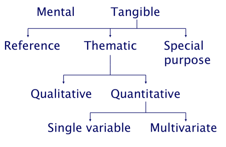
In very broad strokes, here are some descriptions of the three main branches of tangible maps:
- Reference Maps are great for orientation and navigation as they show geographic locations, while being commonly designed to show general distances.
- Thematic Maps are subject dominant and focus on communicating spatial patterns of a particular theme, variable, or subject.
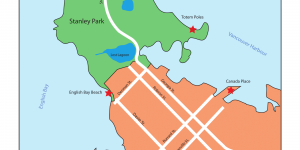
- Special Purpose Maps are maps that are created for very specific purposes, such as the map that I have made which shows notable landmarks or tourist attractions in Vancouver's Downtown Core.
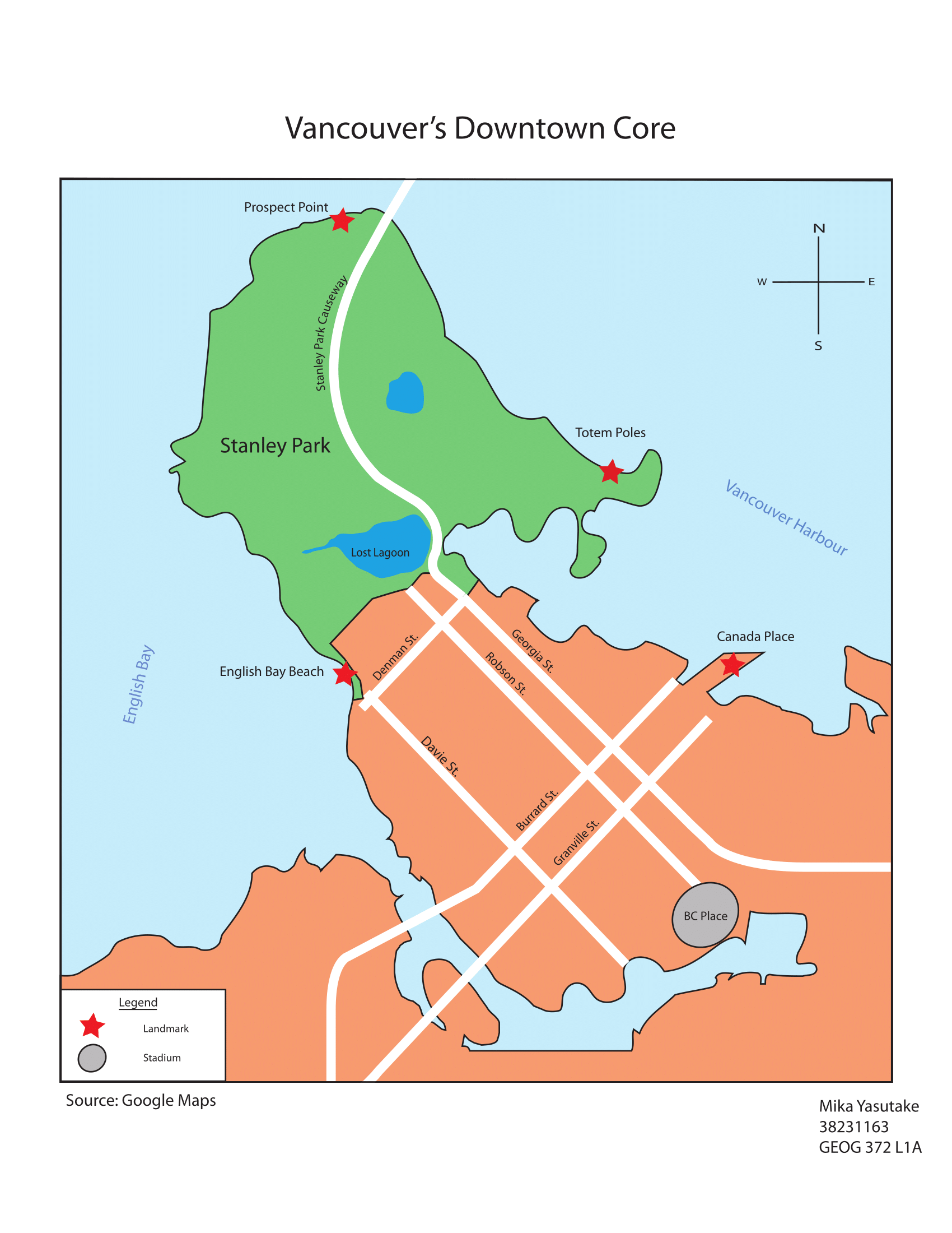
In order to familiarize myself with Adobe Illustrator, I have made a simple special purpose map showing five tourist attractions within Vancouver's downtown core, as shown above.
HERE ARE SOME THINGS I THINK I DID WELL
- Relatively clean line work
- Type and symbol sizing
HERE ARE SOME OF THE SKILLS AND LEssons I'VE PICKED UP ALONG THE WAY:
- Used the pen tool to create polygons and roads, as well as water features for geospatial context with appropriate stroke weights and fill colours
- Symbolized significant landmark features using stars and ellipse tools to give context into the purpose of the map
- Legends are to have descriptive titles of the data that is being represented and can include metadata
- Orange is not a great colour choice for a general fill as it has implications on visual hierarchies
- Holding down <shift> can help to make perfect circles when using an ellipse tool
- Reds are colours to be used with caution due to their implications on colour blindness