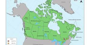
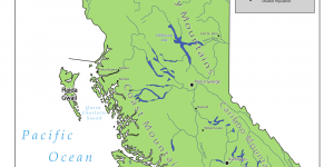
British Columbia’s Major Towns, Cities, and Landforms

For my third week of Cartography, I have been tasked to create a reference map of the major towns, cities, and landforms of my beloved province - British Columbia. The purpose of this assignment is to create adequate visual hierarchies of symbols and to echo this hierarchy through labelling choices.


Canada’s Provinces, Territories, and Major Cities

For my second week of Cartography, I have been given this scenario: I am a cartographer to produce a colour map of Canada to accompany a high school social studies textbook. Using Adobe Illustrator, I explored different stroke weights, symbols and map element techniques in creating this map of Canada's provinces, territories and major cities.


Getting to Know Adobe Illustrator through a Map of Vancouver’s Downtown Core

Welcome to my first taste of cartography! In this assignment, I have been asked to draw a special purpose map of downtown Vancouver. The objective of this task was to familiarize myself with the Adobe Illustrator software, as well as the many tools it contains. This post will walk you through the practice of cartography, different map types, and a few things I've learnt along the way.